Original: $17.90
-70%$17.90
$5.37The Story
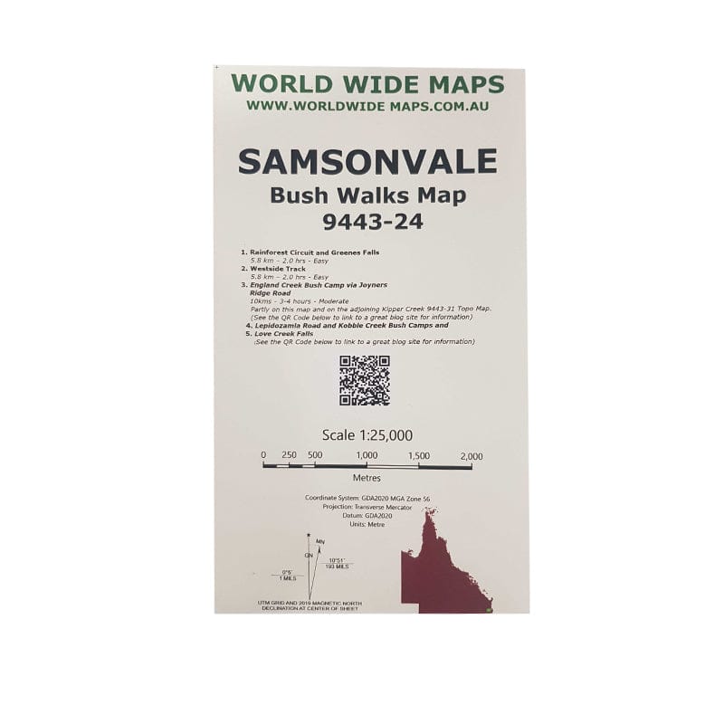
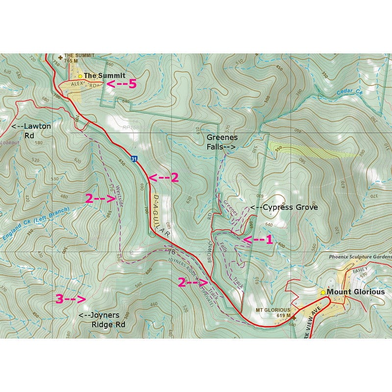
This print on demand 1:25,000 scale topo map Samsonvale 9443-24, replaces the old published map (1981).
The standard topo map has been enhanced by World Wide Maps with 5 bush walks highlighted.
1. Rainforest Circuit and Greenes Falls
2. Westside Track
3. England Creek Bush Camp via Joyners Ridge Road
4. Lepidozamia Road and Kobble Creek Bush Camps
5. Love Creek Falls
The map covers part of South D’aguilar National Park, Brisbane Forest Park.
Details & Craftsmanship
Every detail has been carefully considered to bring you the perfect product.
Description
This print on demand 1:25,000 scale topo map Samsonvale 9443-24, replaces the old published map (1981).
The standard topo map has been enhanced by World Wide Maps with 5 bush walks highlighted.
1. Rainforest Circuit and Greenes Falls
2. Westside Track
3. England Creek Bush Camp via Joyners Ridge Road
4. Lepidozamia Road and Kobble Creek Bush Camps
5. Love Creek Falls
The map covers part of South D’aguilar National Park, Brisbane Forest Park.